One is spoiled for choice when choosing a trek to do in Nepal. My selection criteria was pretty simple: I wanted to do a longer and more challenging trek than the Khopra Danda trek my wife and I had done in 2017. The 3 passes trek certainly fit the bill.
Featured below are some visual highlights from the trek, along with (sometimes very) brief descriptions and insights from each day. For a more detailed description of the trek, click here.
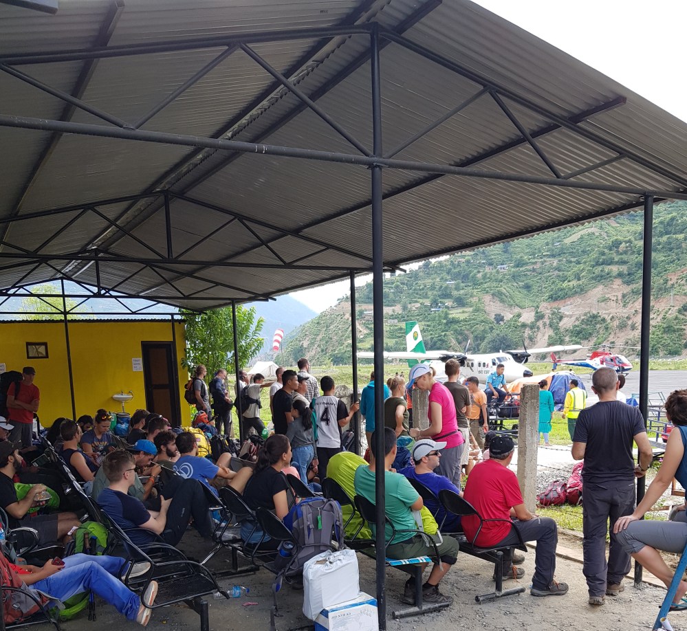
Days 1-2: Kathmandu and Ramechhap
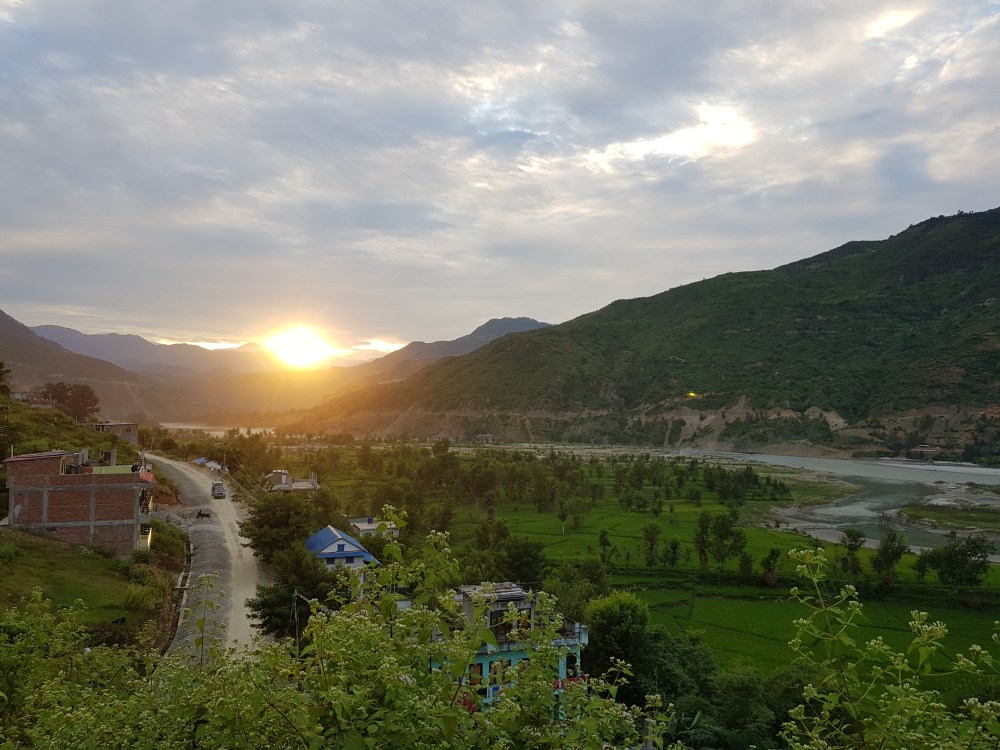
As of October 1st this year, all flights to Lukla are leaving from Ramechhap, a 4 – 5 hour drive from Kathmandu. Arriving around 5am, my guide and I were hoping to get the first flight to Lukla and start the trek. Unfortunately for us, as well as for all the others who had gathered at the airport that morning, all flights to Lukla that day were cancelled (though we were not informed of this until 3pm!). That led some, who had already been waiting there for 2 to 3 days, to abandon their trekking plans altogether, while others to spend $US350 for the 10-minute helicopter flight to Lukla. After the announcement, we jumped in a tuk-tuk and headed to one of the few accommodation options available in Ramechhap, crossing our fingers that the fog in Lukla would clear and we could get on our way.
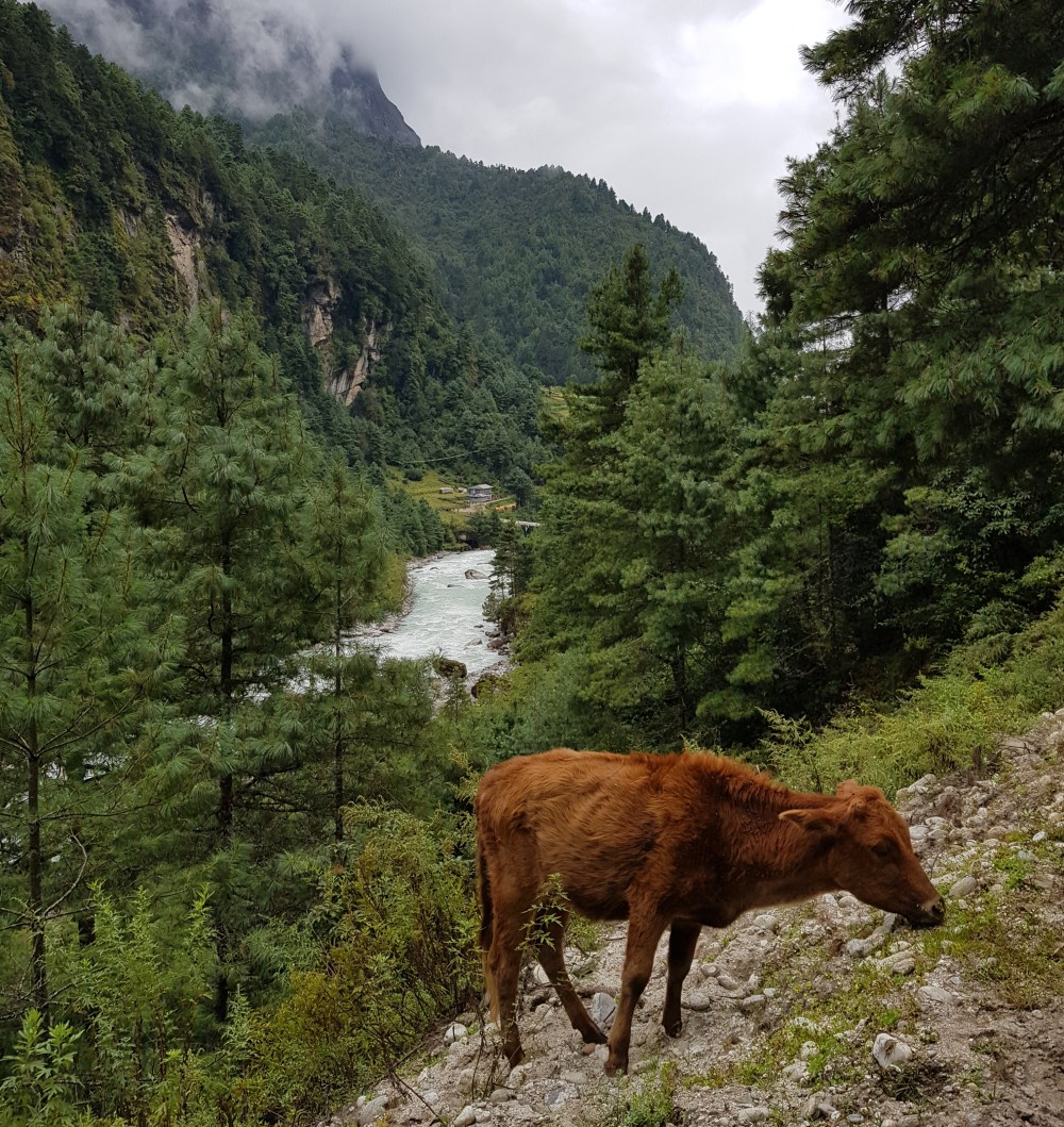
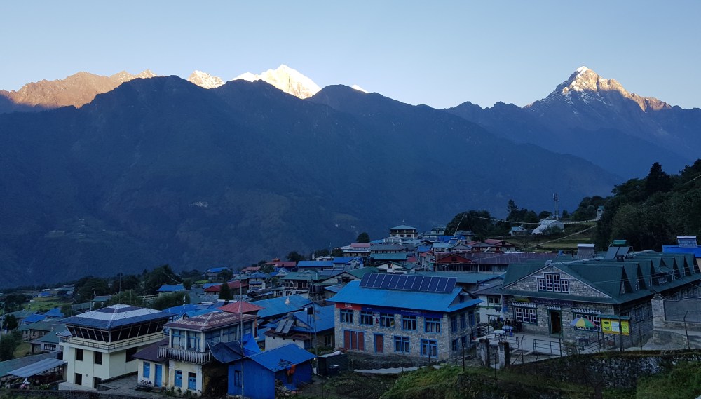
Day 3: Lukla (2610m) to Jorsale (2740m)
“The sense of having ones life needs at hand, or travelling light, brings with it an intense energy and exhilaration. Simplicity is the whole secret of well being” (Peter Mathieson, The Snow Leopard)
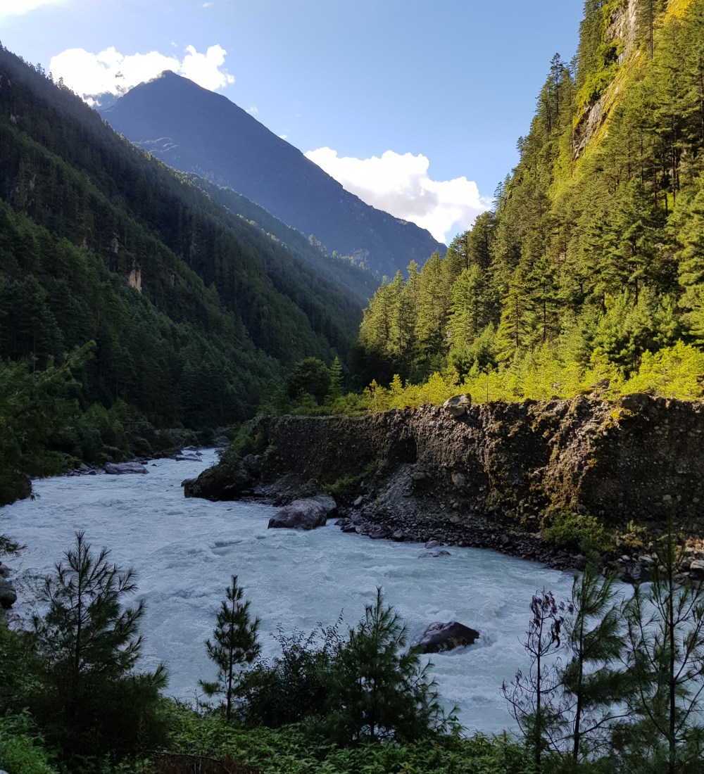
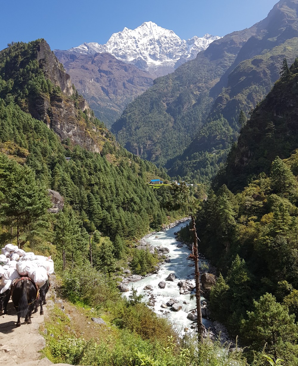
After all the waiting for nothing the previous day, I was both relieved and excited to be able to hit the trails. It was relatively easy day, albeit longer than originally planned, finishing in Jorsale, which sits on the banks of the Dudh Kosi river.
We stayed at a really nice guesthouse that had a large terrace over looking the river (I can’t remember the name, but it’s the first guesthouse on the right after you descend the steps coming into the village). It was here that I tried Tibetan bread for the first time, a tasty fried flat bread which I enjoyed with fried eggs, a meal that was to become my staple breakfast for much of the trek.
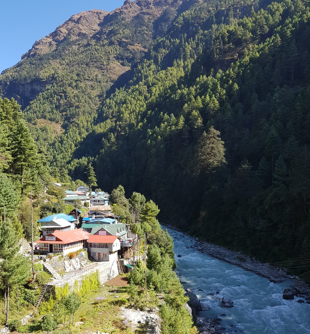
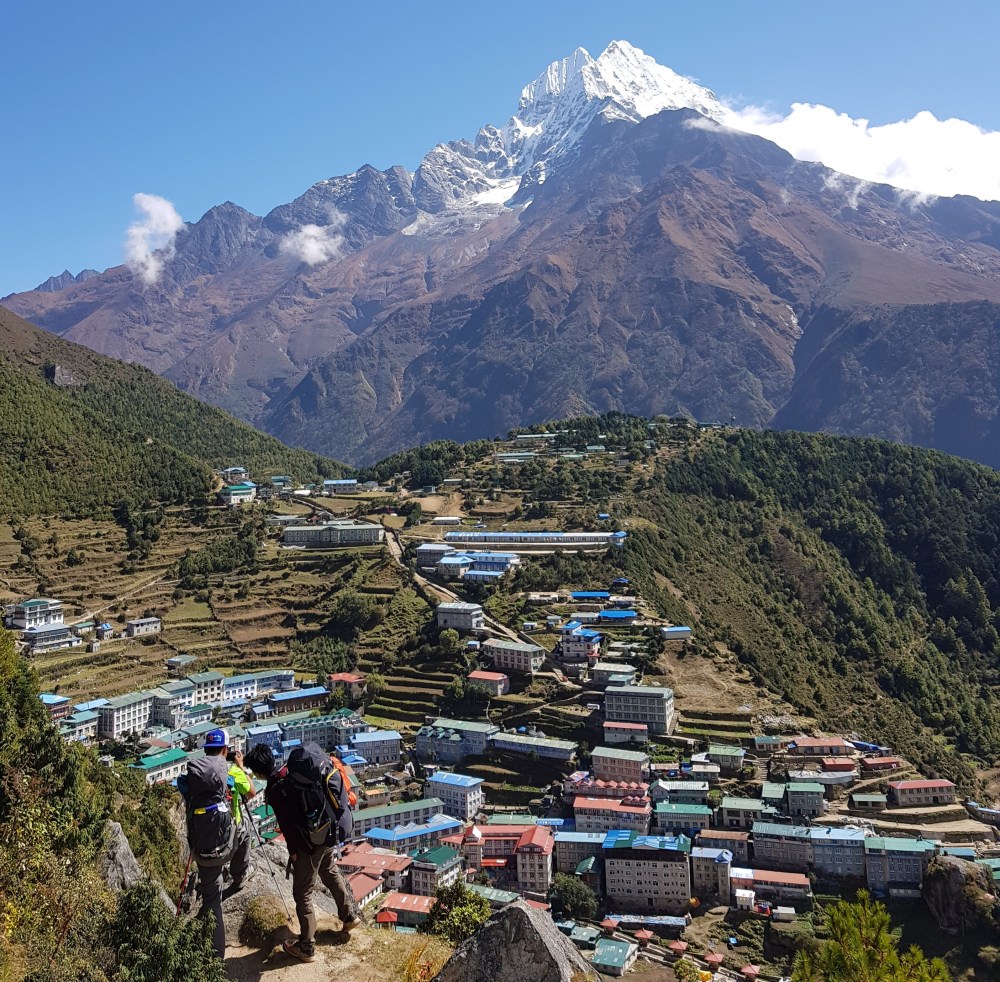
Day 4: Jorsale (2740m) to Namche Bazaar (3440m)
Though mostly uphill, today’s trek turned out to be one of the easiest days of the whole trip, taking only 2 hours to complete. The first part of the trail follows the Dudh Kosi river, passing over a number of impressive suspension bridges, that we often shared with yaks. On the climb up to Namche there is an Everest View point which provided better views of the famous mountain than at least we observed from Everest Base camp.

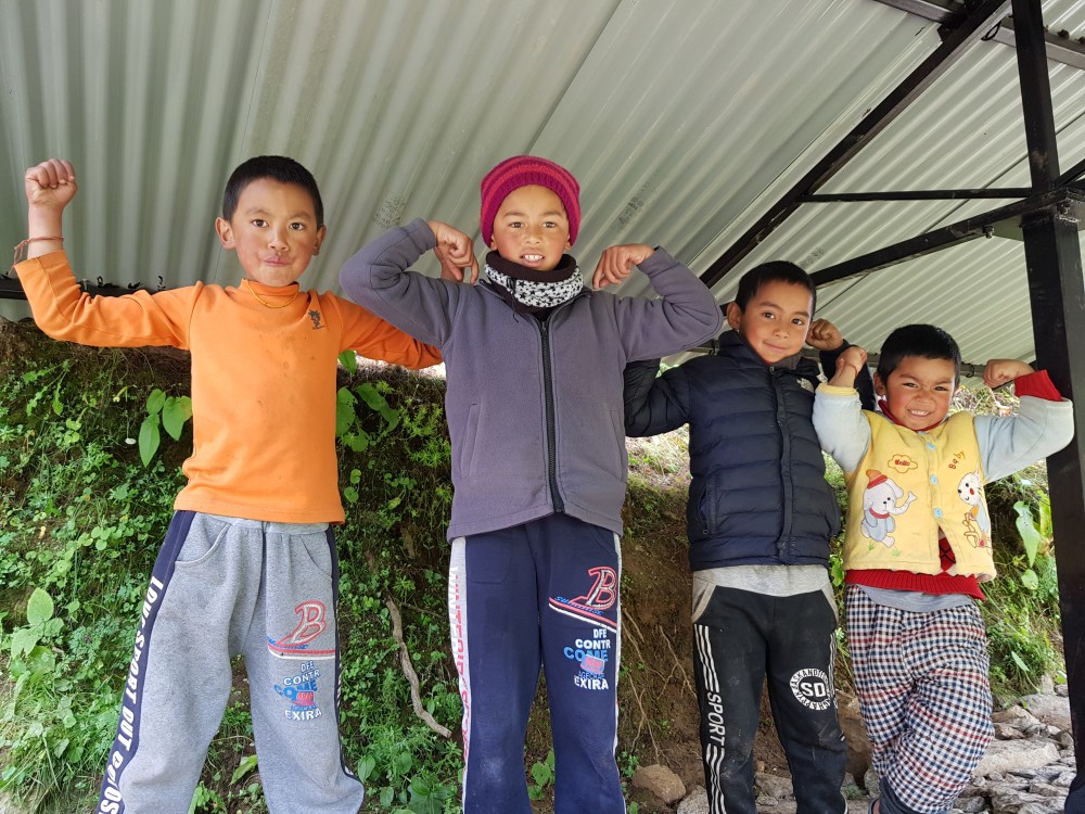
Namche is your the last chance to grab any extra trekking supplies before heading up to the higher altitudes, as well as to access ATM’s. Really it has a lot of things I hoped to escape when trekking in Nepal i.e. bars, cafes, souvenir shops etc. etc. That said, there are scenes which you would likely not see in other commercial hubs elsewhere in the world….

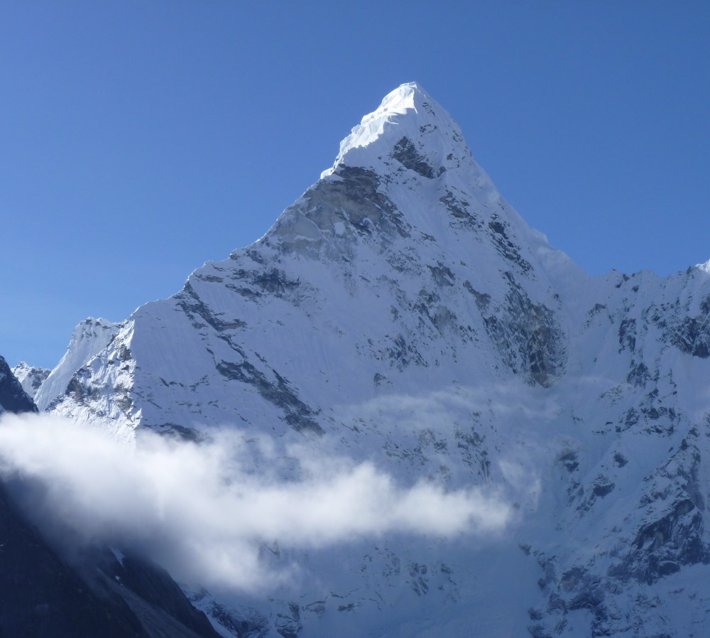
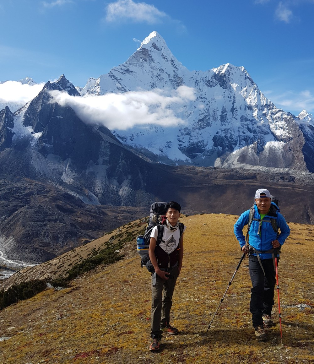
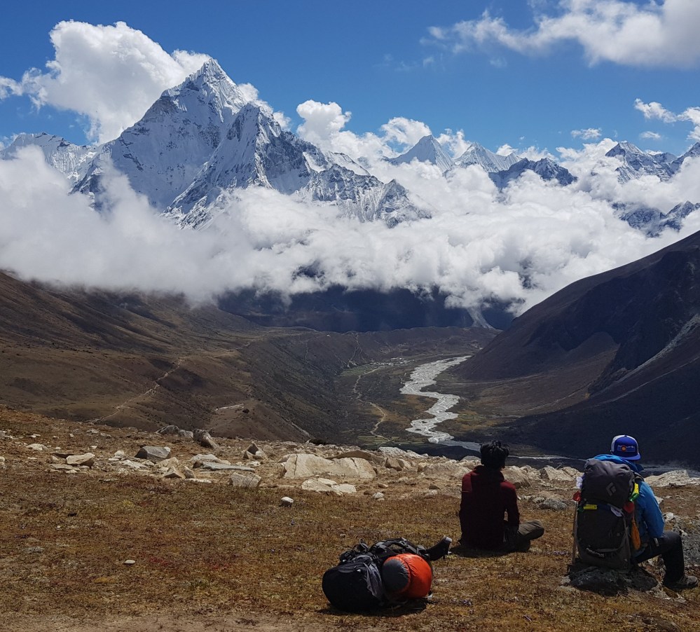
At the guesthouse in Namche I met a 58-year old local who has submitted Everest an impressive 7 times and plans to do so again next year. On this trip he was hoping to help an American man summit Ama Dablam, a mountain I came to admire and take an endless amount of photos of over the coming days.
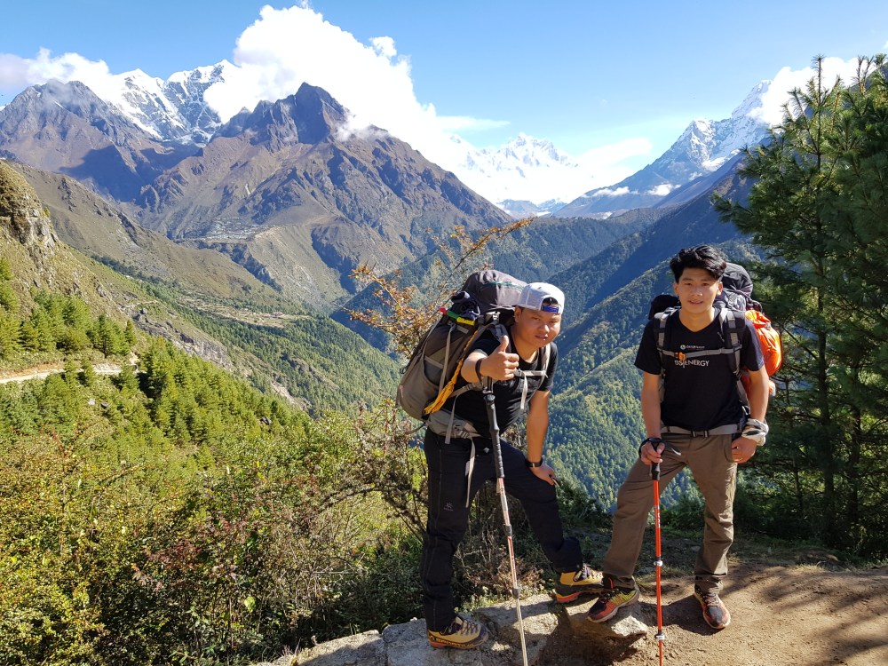
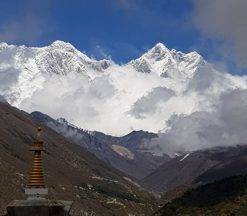
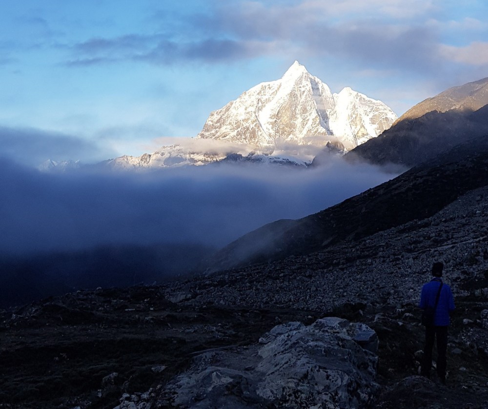
Day 5: Namche Bazaar (3440m) to Panboche (3985m)
When we had arrived in Namche the previous day it had been clouded in fog. In the morning I woke up to this…
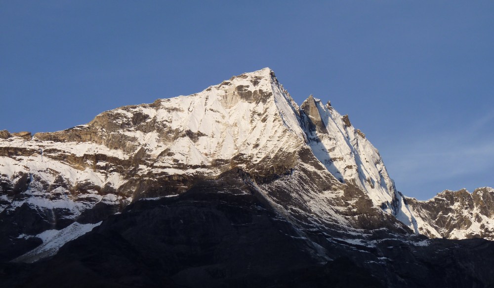
As I heard one fellow traveller say, views in Nepal are weather dependent!
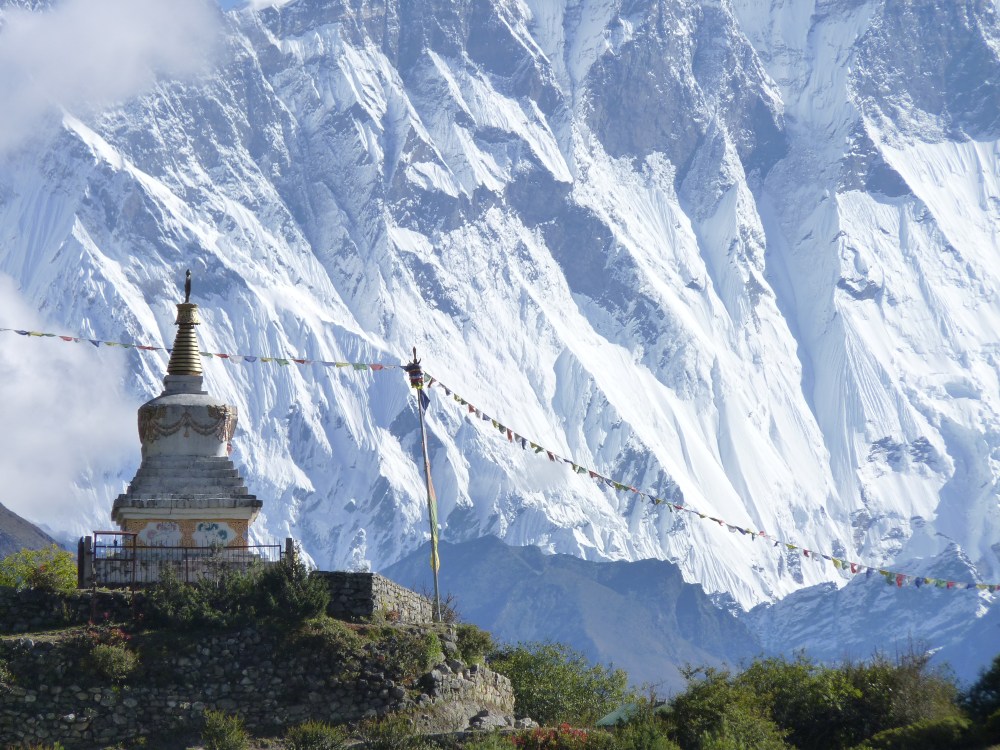
The trail from Namche to a small village that sits at the base of the climb up to Tengboche is relatively flat and comfortably wide, providing great views in all directions. Just as I was imagining how good it would be to train on this trail on a regular basis, a super fit looking local dressed in colourful running attire came charging past in the other direction. My guide informed me that he is very well-known runner likely training for the Everest marathon.

This climb up to Tengboche is quite steep and windy – good training for the more challenging climbs at higher altitudes later in the trek. Near the top the trail passes through some large pine trees, which provided welcome relief from the sun. We stopped briefly look at Tengboche Monastry, which unfortunately was closed.
After Tengboche, we walked for another hour, past a few small guesthouse, over another suspension bridge, before making a small ascent to Panboche. It was here that I had my one and only river wash for the trip, somehow finding the courage to de-robe and wash some gear and an increasingly smelly body as the clouds and fog closed in.
The sight of yaks, and indeed the sound with their “yak bells” on the trails in Nepal is ubiquitous. At the guesthouse I stayed in Panboche I had the opportunity to watch up close some re-fuel and being “de-robed” after another long day at the office.
Day 6: Panboche (3985 m) to Chukhung (4750m)
The trail from Panboche is relatively flat and follows the river all the way to Dingboche. Thankfully we had another clear sunny day, affording fantastic views of the mountains ahead.

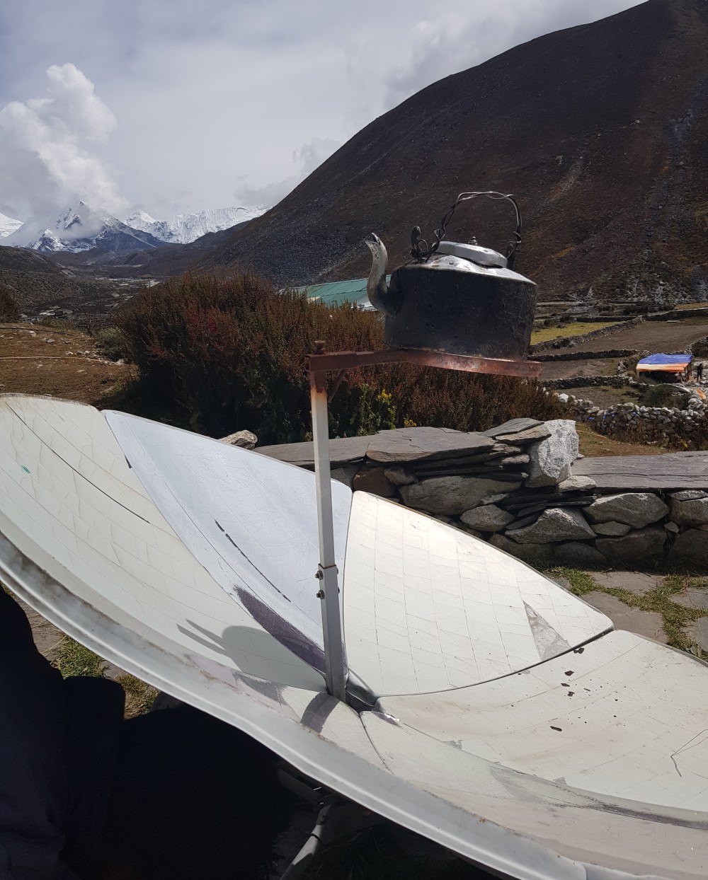
Many of the villages depend on renewable energy sources to generate electricity, including solar. At the guesthouse where we had lunch in Dingboche they were using a rather innovative means of boiling the kettle.
From Dingboche we climbed another ~300 m skyward on a gentle incline to the village of Chukhung, where we would spend the night before taking on Kongma La Pass, the first of the three high passes on the trek. Already feeling mild symptoms of altitude sickness, the prospect of climbing another 800m to the top of what was reputedly the hardest pass on the whole trek made for an anxious night’s sleep. Indeed, at midnight, having lay awake for 3 hours, I decided to crack my first Diamox, which upon reflection I should have started taking much earlier on, given our lack of acclimation days.
Day 7: Chukhung (4750m) to Lobuche (4940m), via the Kongma La Pass (5500m)
From the outset of today’s trek, I made it a point to master my “old man with a cain” walk i.e. a deliberate slow walk, using my walking pole for extra leverage on steeper sections, as a strategy to hopefully ward off altitude sickness. While I did manage to get through the day without suffering any symptoms, the trek still proved to be incredibly tough.
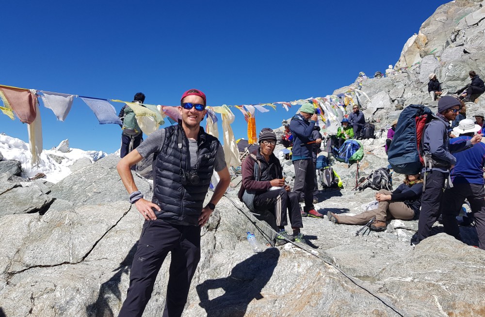
While the first hour or so was not too taxing, the rest of it certainly was. I can say with absolute certainty that the trek up to Kongma La Pass was easily one of the most physically challenging things I’ve ever done. The combination of high altitude, with lots of steep accents, quite simply made for hard work. Where at lower altitudes I had breaks every 15 – 20 minutes, at times on this accent I was stoping every minute to catch my breath. Suffice to say, I was a very relieved man when I finally reached the top of the pass.
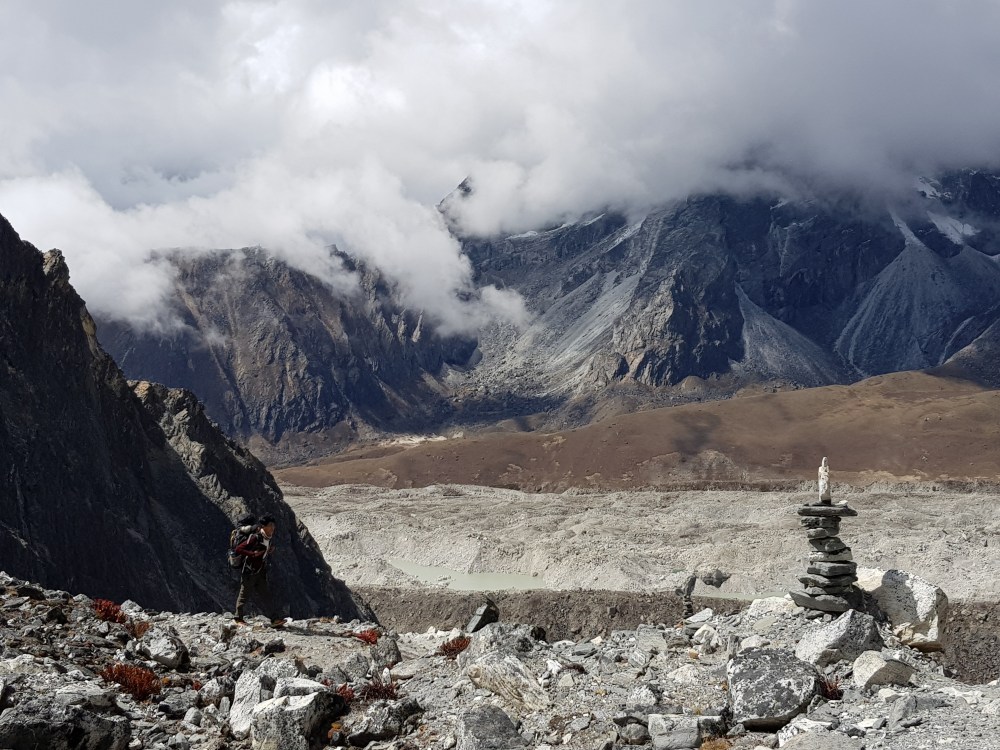
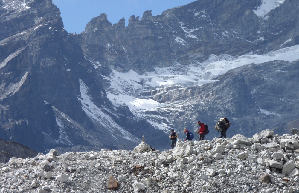
From the top of the pass the village of Lobuche was clearly visible. It seemed all we had to do was carefully get down the steep decent, walk across a meadow, then go up a small hill to reach our destination. If only! What I hadn’t seen was a massive glazier made of mostly loose stones and water hazards, with no clear path to the other side. Having assumed that we would reach Lobuche in 90 minutes from the top of the pass, it took closer to 3 hours.
By the time we reached Lobuche I was completely and utterly exhausted. Never had I been so glad to sit down on some soft cushions and do nothing. That night was easily the best nights sleep I had had on the trek!
Note: There is nowhere if traveling this direction over the Kongma La Pass to buy any food or drink, so make sure you take enough of both to last 7-8 hours of trekking (I didn’t!)
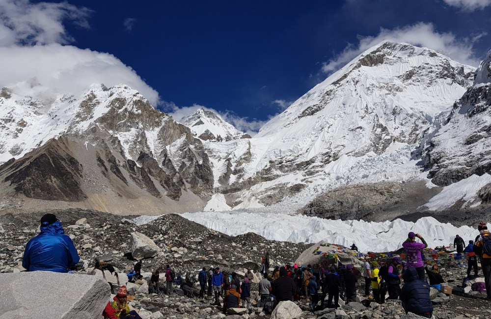
Day 8: Lobuche (4940m) to Gorak Shep (5364 m), including hike to Everest Base Camp
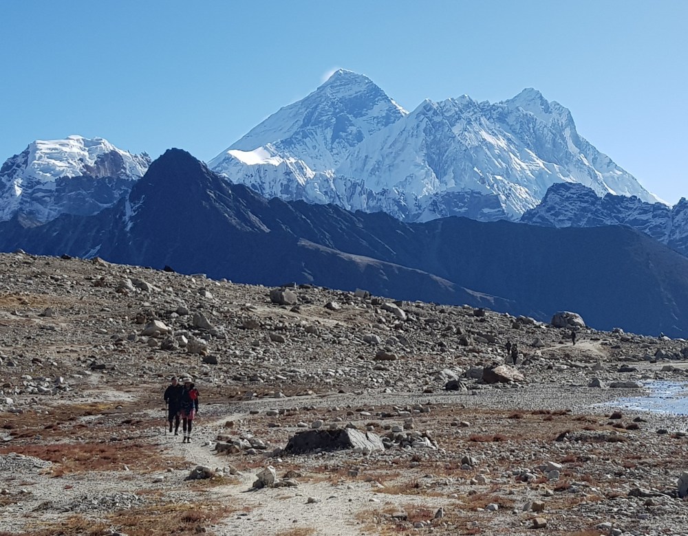
What struck me most about todays trek were the crowds, especially on the section from Gorak Shep to Base Camp, with almost a constant stream of people heading in both directions. It reminded me of the infamous scenes from earlier this year beamed across the world of the traffic jams on Everest itself.
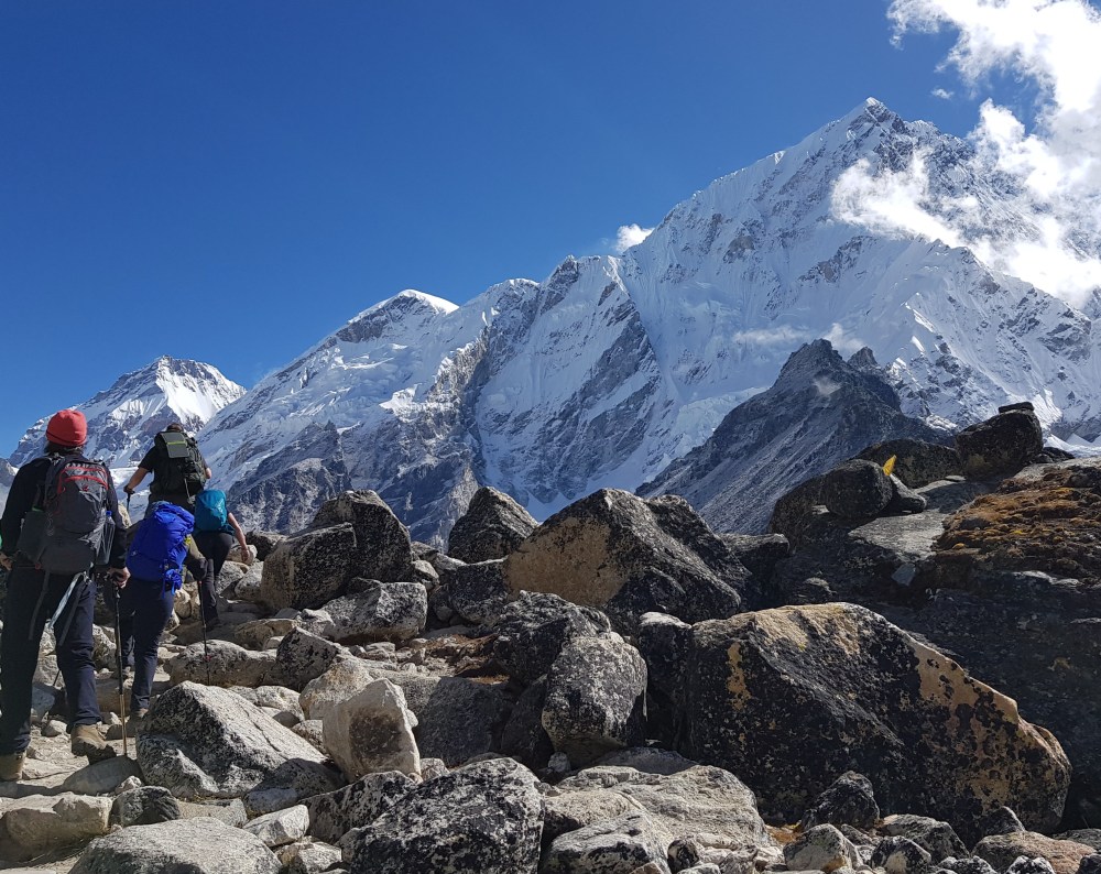
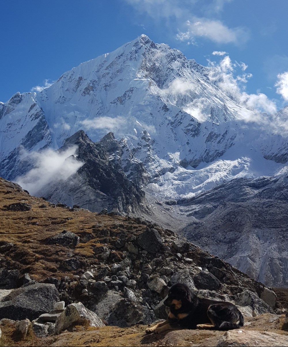
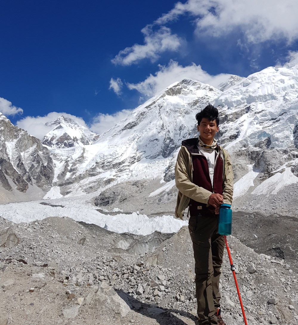
A person I met on the trek described Everest Base Camp as “just a big pile of rocks” – which is not far off my impression. Even given the clear blue skies, the views of Everest are not as good as what I observed from Renjo La Pass or what others observed from Gokyo Ri or Kala Patthar. Views aside, being there did give me a new appreciation of the immense physical and mental challenge that summiting Everest or indeed any other peak over 7500m must represent.
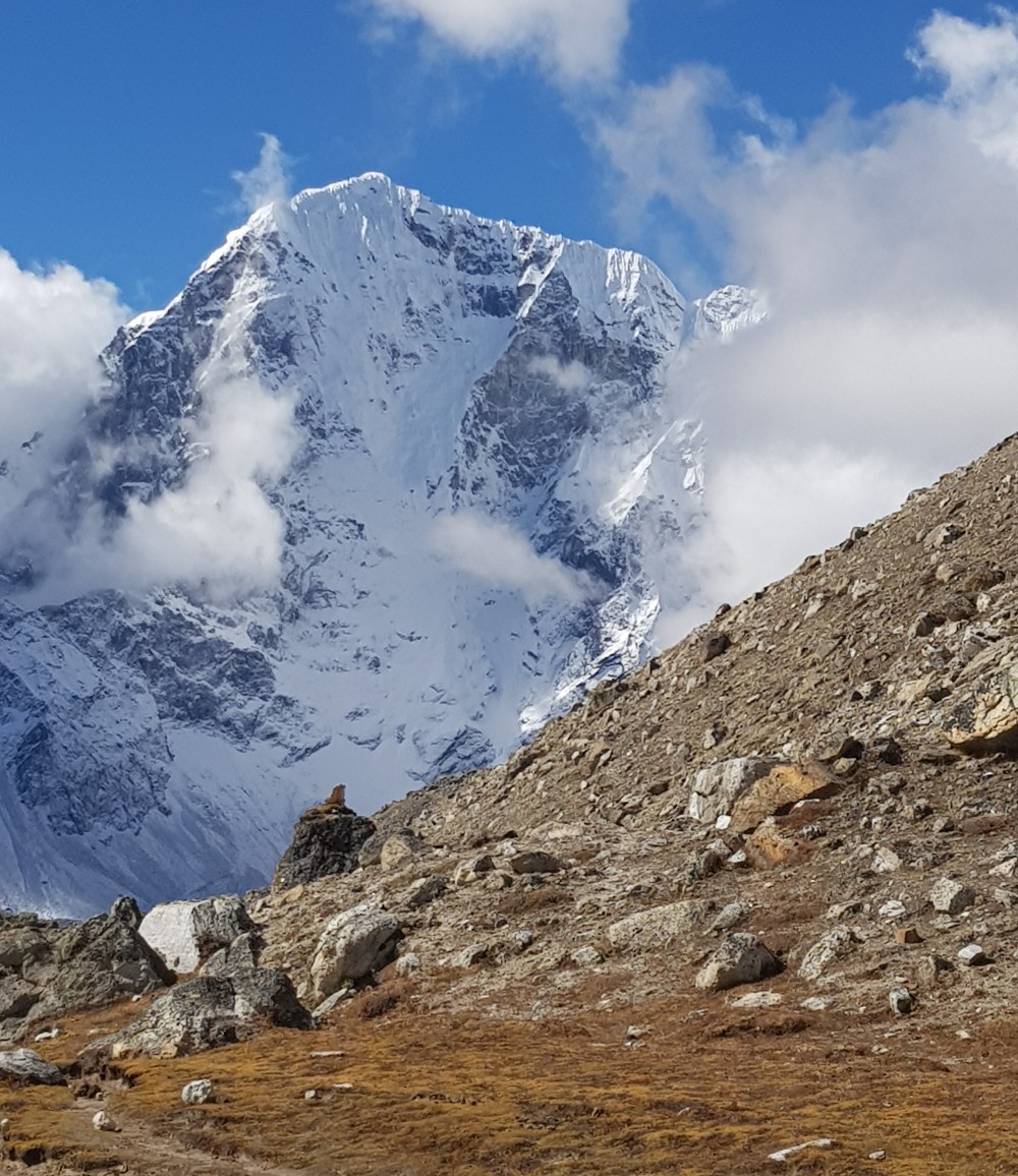
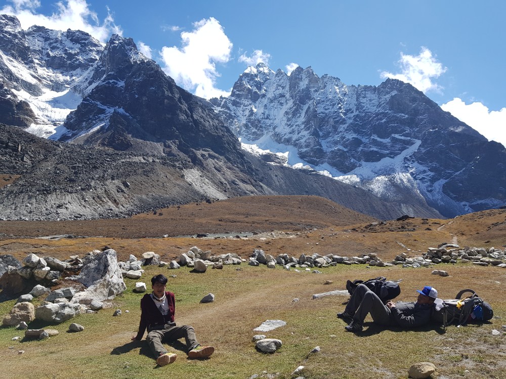
Day 9: Gorak Shep (5163 m) to Dzongla (4830m)
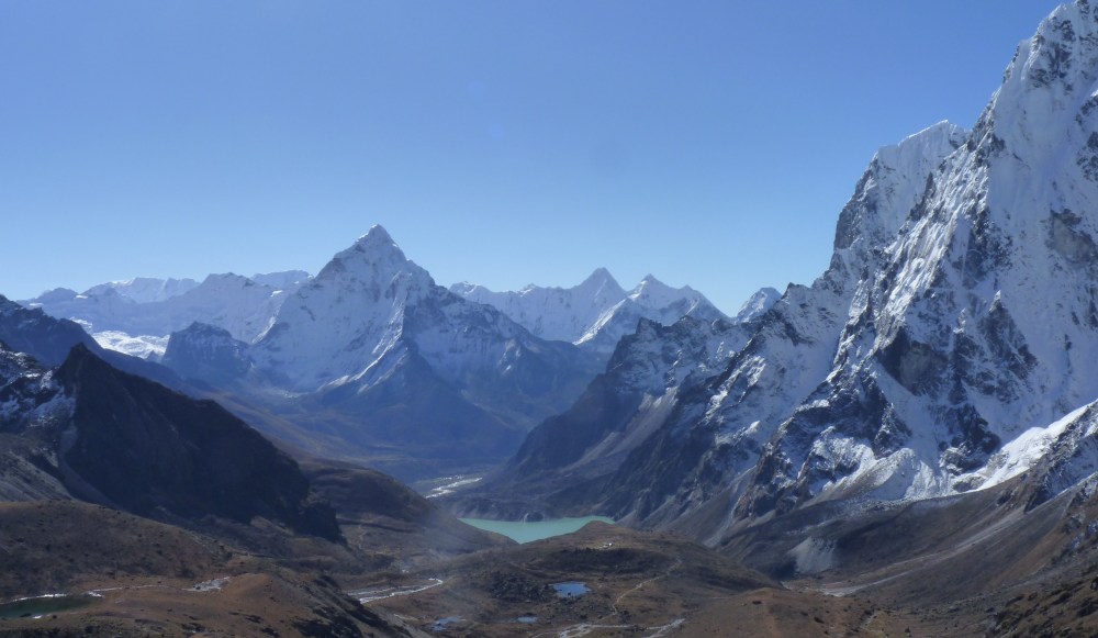
Many people rise very early in the morning to make the ascent up to Kala Patthar from Gorak Shep to capture the sunrise over Everest and some of the other high peaks. My guide advised me to sleep in and save my weary legs for the next few days of hiking, including Renjo La Pass, which he assured me would provide even better views of these majestic mountains.
From Gorak Shep it was a mostly gentle downhill stroll to Lobuche, where I treated myself to one of the most expensive latte/muffin combo’s I’ve ever had at the only café/bakery in town. From Lobuche we followed an often quite narrow single track to Dzongla. From the path we again had some fantastic of the surrounding mountains, including Ana Dhablam.
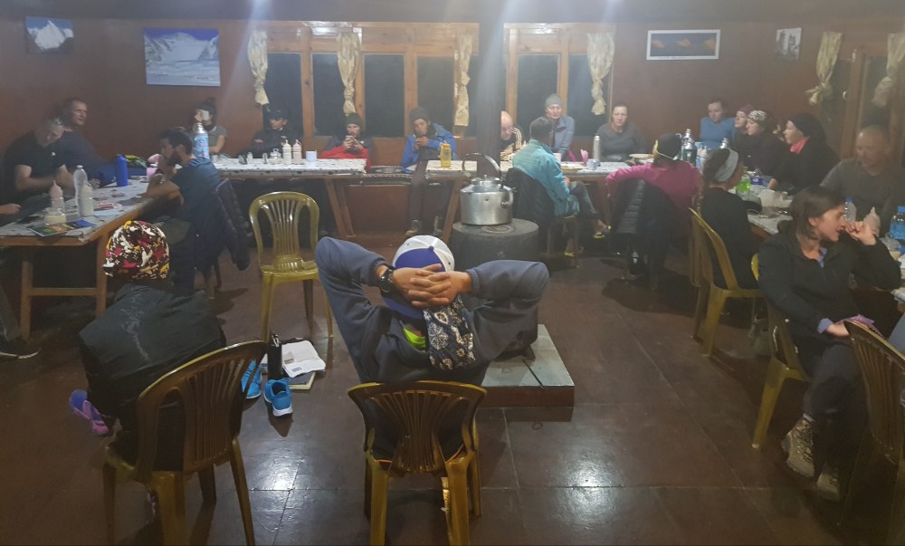
In the guesthouses, most of the hikers tend to relax and recover from their day’s adventures in the common dining area, which tend to be a lot warmer than the rooms. This provides a great opportunity to meet and share stories with hikers from all over the globe, and of course, recover and re-fuel for the next day of hiking.
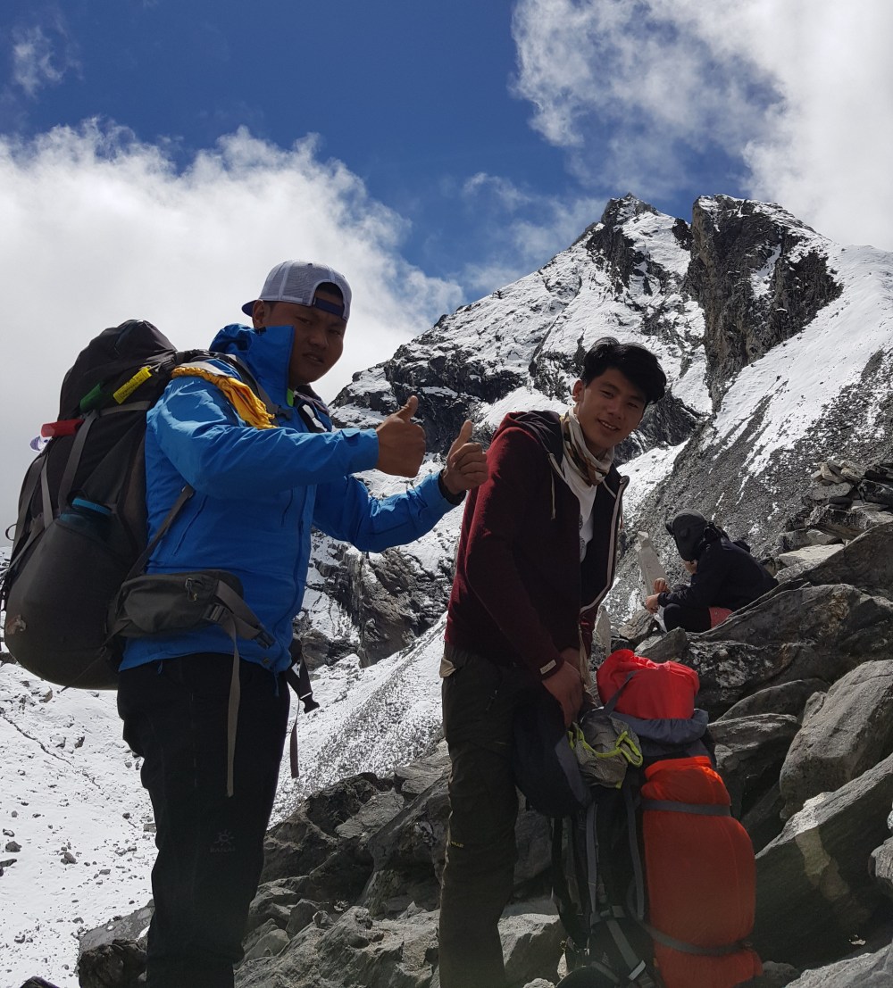
Day 10: Dzongla (4830m) to Gokyo (4750m) via Cho La Pass (5420m)
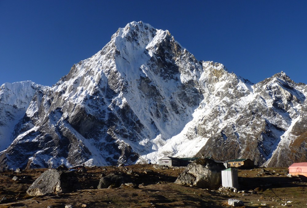
Not long after departing Dzongla does the start of the “real” climbing (i.e. steep sections) up to the Cho La pass begin. After ascending a steep winding path, you come across section of large rocks that is easier to navigate up than it actually looks. Once this section is conquered, it’s a gradual, short climb over a snow covered path to the top of the pass.
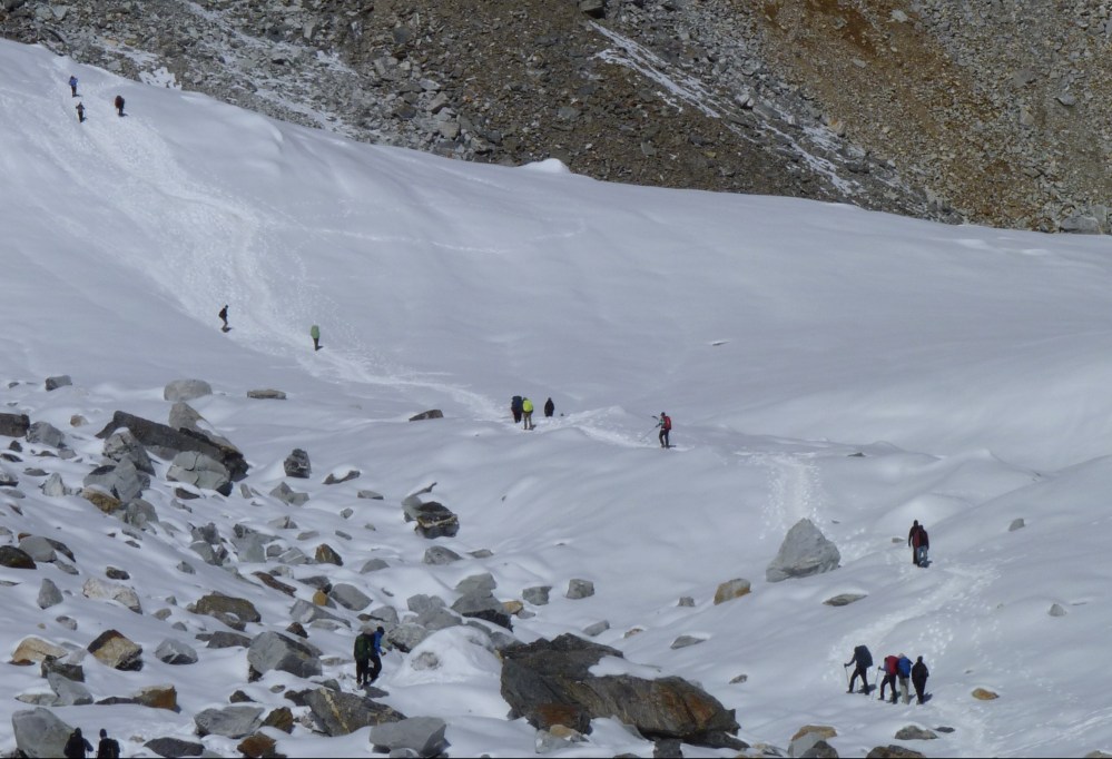
There is some fixed rope for the decent which I found particularly useful given that it was quite steep and slippery in parts. After this there is a little more climbing before the long decent into the village of Thagnak, where we stopped for lunch. As an added bonus to the nice food and hospitality at the guesthouse, the kitchen staff played a few musical numbers once meal service was over.
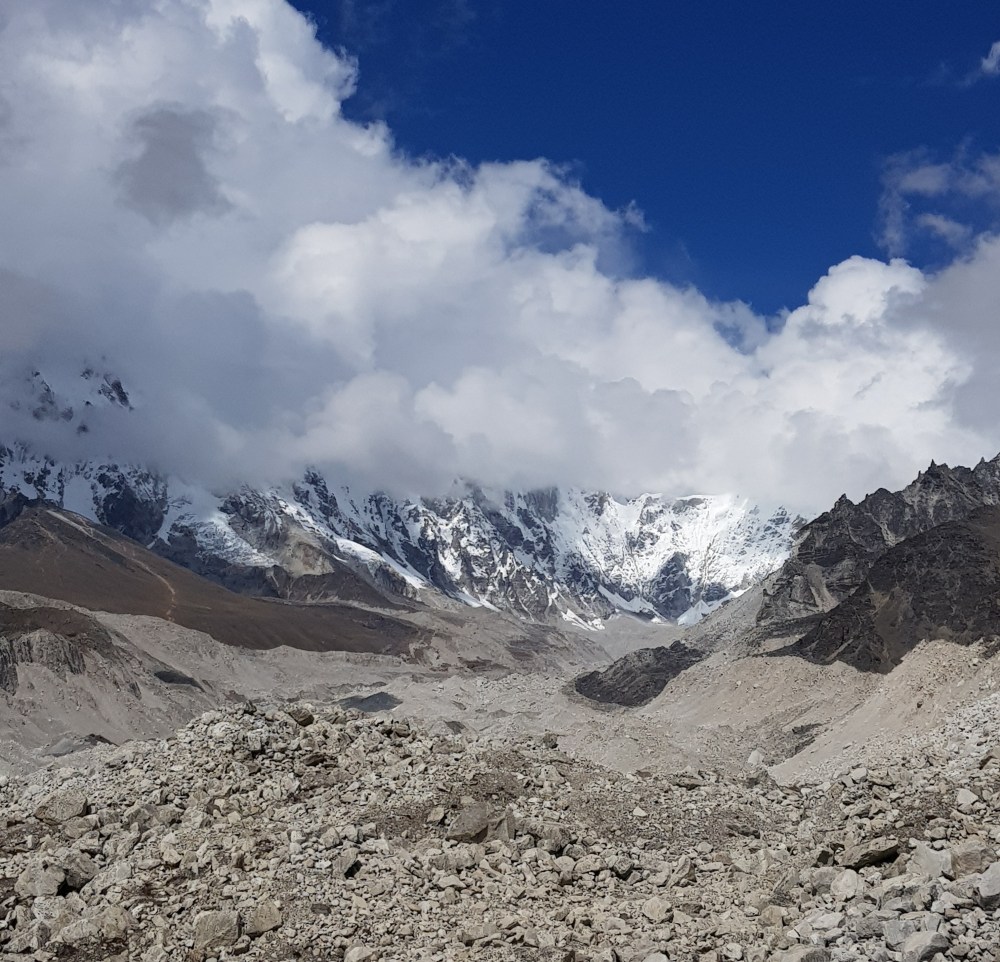
Soon after leaving Thagnak, we came upon another glazier, which I must admit I was not overly thrilled to see given our experience on the Kongma Pass. Thankfully this one proved to be much more manageable.
Soon after conquering the glazier, we came across Gokyo. The picture below really doesn’t do justice to the beauty of this village.
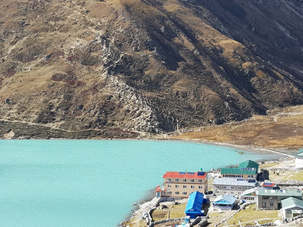
Fatigued from multiple days of hiking, I was more than content to collapse on the cushions in the dining area of the Gokyo Namaste Lodge and enjoy a beautifully warm hot chocolate and piece of banana cake. This post hike sustenance provided me with just enough energy to have my first shower in 10 days. The simple things in life…
In Gokyo, I had my one and only rest day. Though the temptation was immense, I decided not to climb to Gokyo Ri , choosing to save my legs for the hike over the Renjo Pass. Informing this decision was my guides insistence that the views from Renjo were just as good if not better than those from Gokyo Ri.
Gokyo is a beautiful town and definitely a place I would recommend for people to enjoy a rest day and/or to use as a base for a day hikes.

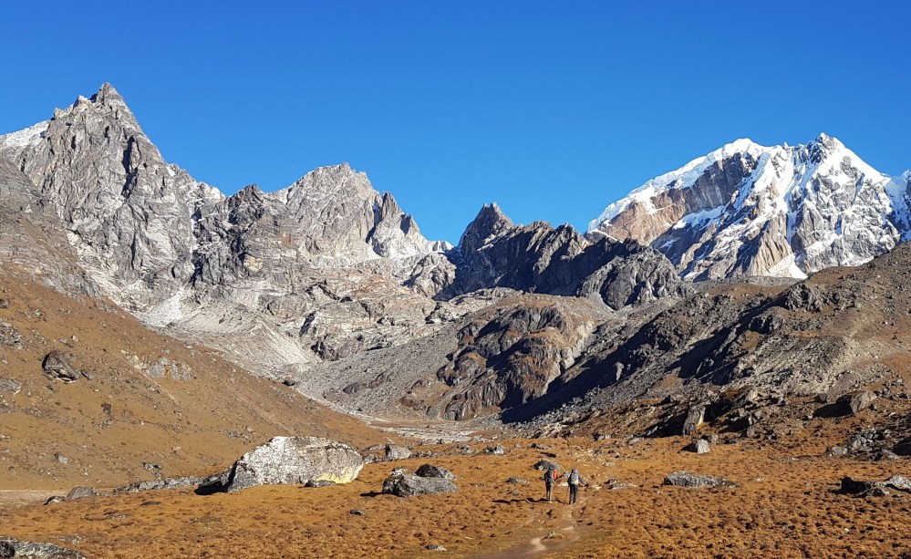
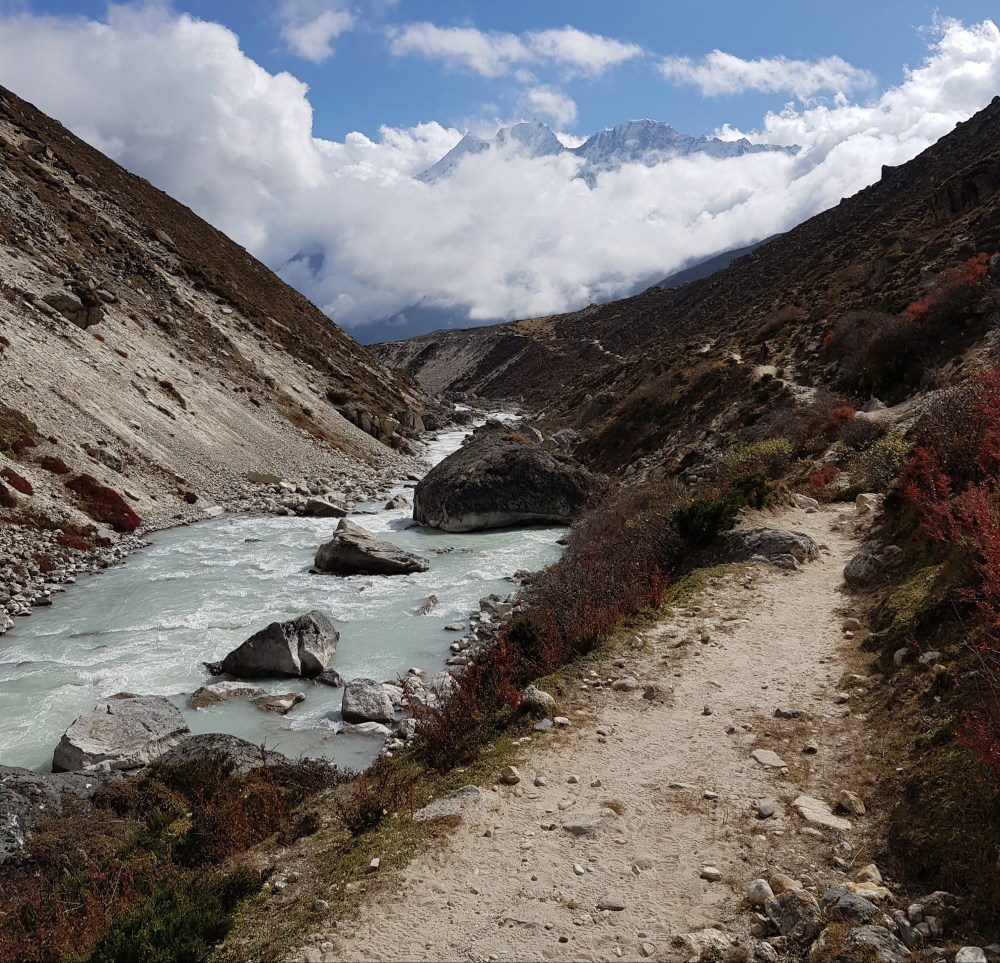
Day 12: Gokyo (4750m) to Thame via Renjo La Pass (5360m)
This was an epic day. Not only for the fantastic views but also for the distance covered (~25 km). The original plan was to stay in Lungde, though my guide suggested we travel further to Thame, I suspect so he could access to better quality/cheaper internet 😊
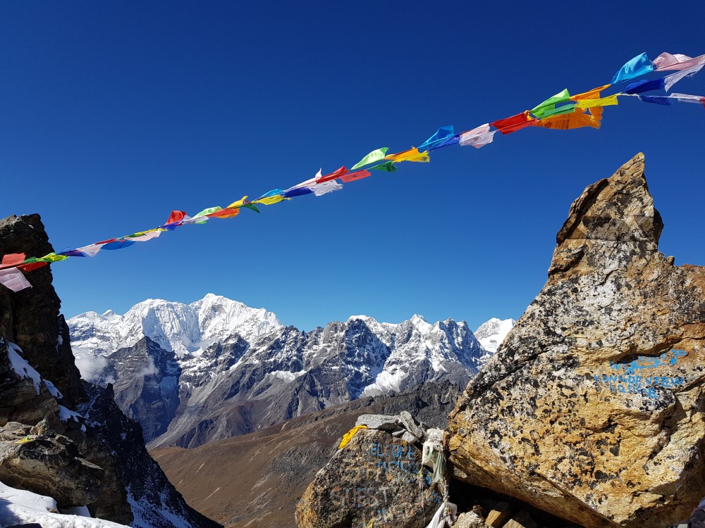
The trek from Gokyo to the top of the pass, which took around two and a half hours, was in terms of difficulty on par with the climb up Cho La and definitely easier than Kongma Pass. The views both on the way to, and from the top were well worth the effort.


Following the short, sharp descent from the top of the pass, the trail gradually makes its way down though some small villages all the way to Thame. After all the up and down of the preceding days, it was nice to be able to stride out on the gentle downward path and enjoy the more oxygenated air of the lower altitudes. On the way we stopped for lunch at a small guesthouse in Lungde where I had my first buff curry (“buff” being short for buffalo). It was definitely one of the nicest meals I had on the whole trek.
Day 13: Thame (3800 m) to Namche Bazaar (3450 m)
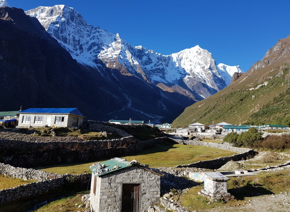
Given the adventures of the day before, I was grateful for a shorter day today. While there are a few up and downs, the trek from Thame to Namche is not too strenuous. Another clear, sunny day provided great views of Namche on the approach to the town.
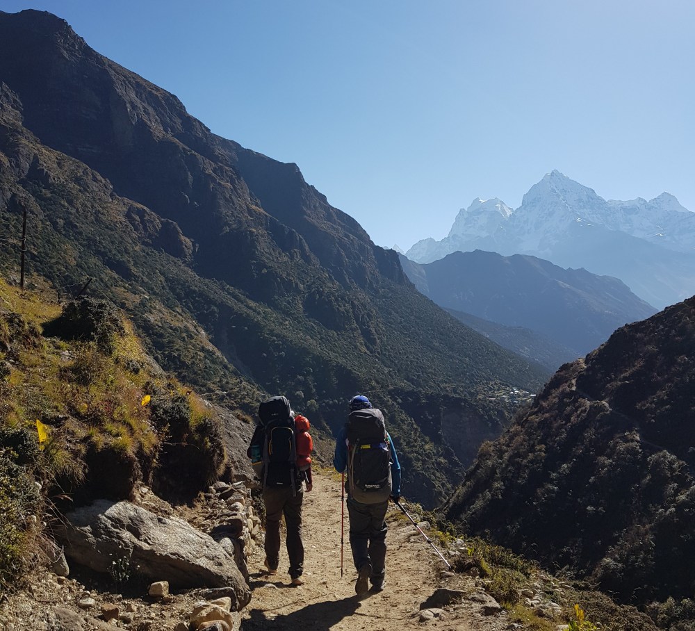
Day 14: Namache Bazaar (3450 m) to Lukla (2800m)
This turned out to be a surprisingly tough day, given the length of the hike, the warm conditions and my suffering my first of bout of gastro for the whole trek (sorry for sharing 🙈)
The first section from Namache to Jorsale is mostly downhill and at times very steep, which I found tough on my already tired legs. By the time we had reached Phakding for lunch, I was ready to jump on one of the many yaks or donkeys also making their way to Lukla!
By days end I was incredibly grateful to finally stumble Lukla. As had become habit, I collapsed on the soft cushions in the dining area of the guesthouse, ordered a hot chocolate and reflected on all that I had seen and done over the past 14 days.

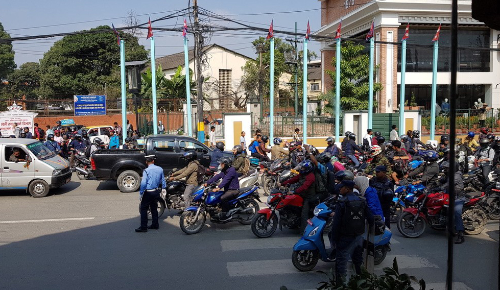
Day 15: Kathmandu
Having completed the hike a day ahead of schedule meant I had a some time to spend Kathmandu. Having spent the last fourteen days breathing in fresh mountain air, enjoying blissful quiet and not seeing even one motorised vehicle, Kathmandu had me yearning to get back on the plane to Lukla!
Random trip notes
- My trip was organized through kimkim, specifically by Ngima Dorji Sherpa, who also runs tours through his own company Nepal Myths and Mountain Trails. Ngima was incredibly helpful in tailoring the trek to my needs and ensured that all I had to worry about when in Nepal was having the energy to get through each days hike!
- For drinking, I used water purification tablets, from which I had no issues. I noticed quite a few other hikers using the LifeStraw and Steripen, that I think I would be more inclined to use next time.
- While a small number of guesthouses offer facilities for card payment, on both occasions that I tried to use them they didn’t work, so take plenty of the local or US currency with you. Be mindful also that prices for most things (i.e. phone charging, wifi, boiling water, meals) tend to increase the higher you go up.
- Build some extra days into your itinerary. Flight delays and cancellations are common in Nepal, so having some extra days up your sleeve means you will be more likely to be able to complete the trek as planned.
- There are plenty shops selling books that are either set in the Himalayas or detailing expeditions in other parts of the world. Two that I have really enjoyed are The Snow Leopard and Ghosts of Everest, both of which I found inspiring and humbling for quite distinct reasons.
- Though I didn’t quantify it, despite my best efforts, I did lose some weight during the trek. So putting my nutrition hat on, two items I will take next time to help counter this are peanut butter (to add to bread/pancakes or porridge) for an extra energy and protein boost, along with some carbohydrate/protein recovery powder, to use on its own or again added to porridge/muesli/hot chocolate.
- Best t-shirt I saw on the trek: “Same t-shirt, different day” – same for socks, shorts and dare I say it, underpants😉.

Love how detailed, informative and interesting this blog post is!
LikeLike